Showing posts with label hiking. Show all posts

Monday, May 7, 2012

The Trifecta of Quetzaltrekkers Hikes

I haven't gotten the chance to write in a little while. Partially because I don't want to waste time on the computer, and partially due to the lack of internet. Two weeks ago, Nico and I hooked up with an organization here called Quetzaltrekkers. We saw that they were running a 6 day trip from Nebaj to Todos Santos, and though it sounded really cool. As soon as we got to Xela, we made sure to sign up. Quetzaltrekkers (QT) is an organization that was started to raise money for a couple projects here in Guatemala. At first we were a little turned off that the guides were almost all foreigners. Seemed like it would be better to be guided by a local and have the local earn the money.
Turns out that all the guides are totally volunteers, so that they can raise as much money as possible for their main project, Escuela de la Calle, along with a few others, which get underprivileged kids off the streets and into school. The guides don't get paid at all... meaning they have to pay their own food and accommodations as well. They all speak Spanish and English and really know the areas. Even while on the treks, they do their best to make sure that money spent goes right to the locals as much as possible. On the treks, we sometimes stay with families in small villages. These are places that don't even have a store, let alone a hostel. It was really neat that they let us sleep in the school, and each time a trek comes through, they rotate what family gets to cook for us, and therefore a significant financial boost for a hard days work.
Steve entertaining all the kids
Anyway, back to the Nebaj trek. Day 1 was just a travel day to get there and then check out the town of Nebaj. Steve, a new guide, also plays ultimate and happened to have a disc with him. We start throwing around in their central plaza, and very soon we had a crowd of young boys looking curious. So we start throwing to them and before we knew it, everyone was looking on, and all the young kids were trying to get our attention to throw it to them. This eventually ended when a bunch of boys got into a dogpile all fighting for the disc. So we take it away, but they all follow us to where we sit down. Also turns out that Steve worked for an orphanage in the jungle for 8 months and was great with the kids. He starts doing this clown routine, and messing with them, and they were all mesmerized.
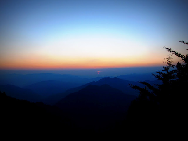
On the way up to the altiplano - early morning start
the altiplano
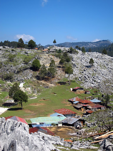
The next 4 days was the hiking. It reminded me a lot of the foothills of the Himalaya. Very steep rolling lush hills. It was quite green, even though the rainy season hasn't even started yet. Then on day 2 of hiking we got up to the first altiplano. It was totally unlike anything I've seen before. There were grassy rolling hills with large limestone boulders scattered all over, with pine forest all about. Even crazier is that these boulders were once on the bottom of the ocean! Amazing geologic forces pushed them all the way up to about 12,000ft above sea level.

The next few days brought us up over hills and across river valleys, in what was some very impressive scenery. It's crazy that almost no tourists make it to these areas of such great natural beauty. In some of the villages on the altiplanos, QT are the only foreigners that these people ever see. It is very strange to see people just stare at you, or even run away at the sight of a white person. Although based on their reactions it must be way weirder for them seeing us than it was for us to see them. Our guides were telling us that a few weeks ago on the trek, someone pulled out a camera in one of these villages, and all the kids immediately fell to the ground. They were legitimately afraid that the camera would steal their souls. I've heard about it before, but never thought I'd actually be among those people. And for that reason we are asked to not pull out our cameras around them and to make sure to ask people if it is okay that we take a picture.
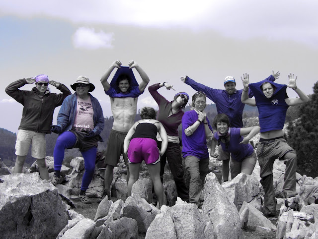
Team Purple!

What also made this a great trek was the group. Everyone meshed really well together. It was a small group, 9 total, and so we all hung out together and got to be friends. On our next trek, the Lago trek, our group was 17 people, and so you just could not bond with everyone in 2.5 days.
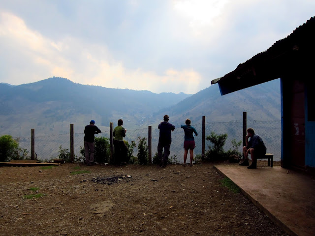
Nico and I heard that Lago Atitlan was a really nice place, and planned to check it out. It just worked out that QT was running their Xela to Lago trek two days after we got back from Todos Santos. So after one rest day, we were ready to hit the trail again. I can see why this trek is so popular, with see some really great scenery and being only a few days, and it goes to where people want to end up anyway. QT will even drop off a bag for you at the end so that you don't need to carry all your stuff.

It was another great trek, but not quite as good as Nebaj. The scenery was good, but not quite as amazing and remote as the other trek. One sweet highlight though was that on the last day, you get up at 3:45am, and hike to a nice mirador for the sunrise. We got there just as the first hues of light were on the horizon, and you could see the lights of San Pedro below, and also just make out the 3 volcanoes that run along the southern part of the lake. It was quite a beautiful sunrise, until just before the sun poked up when a bunch of clouds rolled in and kept us covered until the sun was well up in the sky.
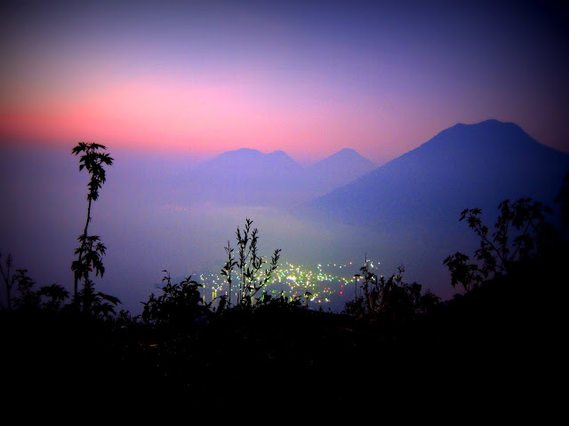
Sunrise from the mirador
Then we were left in San Padro will all of our stuff and no plan. Typical for us.... San Marcos, across the lake, sounded like an interesting place, so we took the ferry there. What a weird place. I really liked how for the part of the town that was near the water, there were no roads. It was just footpaths winding amongst the trees and shrubs... and also the hostels and meditation centers. It was a very idyllic tropical place, but nothing there felt like Guatemala; it could have been anywhere. The people were the weirdest part. It was a hippy haven, and all of them with the weird clothes and crystals on their foreheads made me feel so damn normal.
Lago Atitlan
It was a nice chill time though, until the next morning when we were feeling like we really needed to figure out what we wanted to do with our last week here. Since there was no internet to be had in the entire town, we packed up again and went back to San Pedro, which was a bit of a bigger town and also party central. It was really odd when the next morning at 7am we were trying to find breakfast, and the only store open was a liquor store... Anyway, it took us all afternoon but finally we came up with a plan. I had wanted to go to the jungle and Tikal, but it was actually really far away, and would have been such a pain to get there. We decided on heading back to Xela to do more hiking! Before that though, we went for a kayak on the lake, and also spent a night in Chichicastenango which has one of the largest markets in Central America.
From our paddle on the lake.  The water has risen quite a bit in the past few years....
Chichi was actually quite a nice little city. Saturday evening as we were walking around, many people were starting to get set up for the big Sunday market. Neither of us are much of the shopping type, but it was still interesting to wander around and see what there was to see there. Then it was an easy few rides on the chicken busses back to Xela. Xela kinda feels like our home here in Guatemala, and it was good to be back in time for the potluck dinner with everyone from QT.
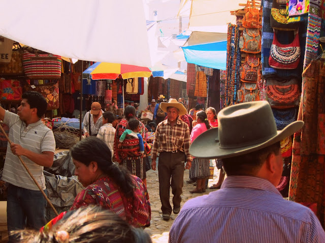
From the market in Chichi
For the third QT hike, we will be doing a full moon hike up Santa Maria. It hasn't actually happened yet, but it will be basically the last thing we do before heading back to Guatemala City and flying back to NY the following day. I am really hopeful that this time we will get good views of Santiaguito which is the very active volcano that we attempted to see a couple weeks ago. Starting the hike a bit before midnight should put us on the summit well before sunrise, when the skies are the clearest. Wish us luck!

And of course to view more awesome pictures that we took (all from Nico's camera though)

Monday, April 30, 2012

Hiking notes to the Santiaguito Mirador


After Nico and I got to Xela, we decided to go do some hike that we can do on our own. This hike is generally able to be done without a guide... as long as you don't mind getting a little lost... Although if you are going to do, maybe this will help.

On sunday night Quetzltrekkers (the organization that we just trekked with – that'll be another post) has a potluck dinner that we went to. We met Katie, and guide, and Steve, a potential guide, who were both interested in coming on the hike with us. Katie had been to the mirador once before, so she at least had some idea of what we were looking for.

The walk starts in a nearby town called Llanos Del Pinal. You can catch a chicken bus headed that way (says Llanos Del Pinal on the front) in front of Iglesia El Cavario. When standing with your back to the church, you want a bus headed out of town, going to the right. The day we went, we waited for about an hour and the busses were only going in the other direction. Eventually we got on one of those, and it turned out that the busses were heading out of town along a different route...

Get off the bus in Llanos (ask the driver when to get off for the volcano) and walk up the one main road through town. Its the only road headed towards the conical mountain – Volcan Santa Maria. Once the buildings end, the road veers right, but you should take the obvious trail in the drainage gulley that heads straight.
Where you catch the gulley
Follow the gulley for a while until you get to a row of spikey trees on your right. Follow the path straight. (one goes off to the left as well which will take you up Santa Maria)
The row of spikey trees
Very soon after, you will come to a fence on your right, and the trail splits. Follow the trail straight ahead, and not the one off to the left.
The fence
Soon after that, you will come up to a field and merge onto a dirt road. Follow the dirt road straight (a couple paths veer off, but just stay straight). At the end of the road, you will come to a grassy field, and should continue straight through the field as well.
The grassy field
From here on out, just follow the most obvious path. If it starts to dwindle out and not come back, then you probably took a wrong turn. A few places you will need to climb over a fence of sticks, but keep going. The only thing worth noting - at one point you will come to a gully. The lower path leads right to something that looks like a road block (fence of sticks). That is the path to take, and not the upper one which goes up and around the gulley.
The lower path across the gulley
A little bit farther, and you will come to the mirador (lookout). The path continues and a couple minutes more you will come to the point were the side of Santiaguito blew away in the 1902 eruption. Well worth a look.

Unfortunately for us, we got a bit of a late start, and with getting lost a few times it was clouded over by the time we got to the mirador. The recommendation for this is to get a really early start (5:30 or 6am walking from Llanos) in order to get there before the clouds roll in. I still kinda want to go back there and maybe even just climb to the top of Santa Maria, cause I really want to see an active volcano. Supposedly Santiaguito erupts about every 40 minutes. We heard it go off once on the way to the mirador, but it would be sweet to actually see it spew some ash and rocks.

Anyway, maybe this writeup will help someone else get there in time before the clouds roll in and obstruct the views.

Saturday, April 21, 2012

I'm Nomading Again!

Now that I have been back in Ithaca for exactly one year... its time to travel again!  Funny that it has been 1 year to the day from when I returned to Ithaca, to when I flew out to Guatemala.  April 18.  Anyway, Nico has been down here in Central America for a couple weeks now, and it just seemed silly that I was in Ithaca, not even at a real job, and and not traveling with her.  This time we actually have return tickets though - May 10, two days before Rachel graduates college.
Arches in Antigua
So anyway, it seemed kinda surreal as I was taking a taxi from the airport in Guatemala City to Antigua to meet up with Nico.  It's been so long, and its clearly not the US (although not as much different as I was expecting), but it seemed so normal to be there and barely able to communicate with my taxi driver.  Although of the three of us passengers I was the one with the most Spanish skills, and attempted to have a little conversation with the driver.  I am definitely pleasantly surprised how much I remember, considering I haven't taken any Spanish since 11th grade.

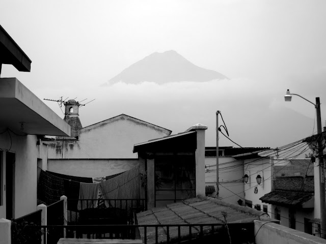
Volcan Agua looming over the city.  View from the
balcony of our hostel.
I met up with Nico in Antigua and it was really awesome to see her again.  Unfortunately Antigua turned out to be a bit of a letdown.  It is totally gringo central, and it seems like the Guatemalan culture there is not so genuine, and everything is really just to cater to the tourists.  It is certainly a nice city, with cobbled streets and some different architecture than I am used to.  There was a definite lack of street food and hole in the wall family restaurants... and so we actually ended up cooking most of our meals there.  We spent one day getting our bearings straight and wandering the city, cause that's what we do.

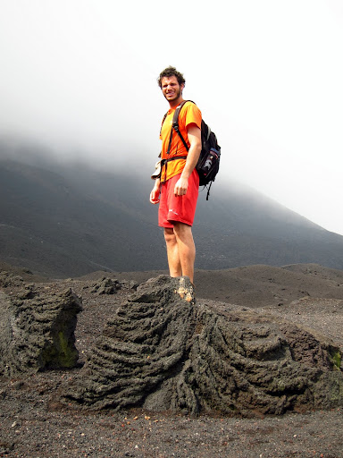
Then yesterday morning we went on a guided hike of Volcan Pacaya.  Pacaya is an active volcano about 1.5 hours drive from Antigua (depending on how many guesthouses your shuttle stops at on the way).  I feel like this was in line with the spirit of Antigua so far, kinda nice, but not as good as we were expecting.  It was a nice easy walk up, in a group of 13 with a guide who at least spoke clearly and slowly such that I could actually understand everything he said.  We were not allowed to go all the way to the top cause they are afraid of us falling through an old lava tube... fair enough.  There were some neat spots though where steam was coming up through the rocks.  It seems to the traditional tourist thing to bring up a bag of marshmallos and roast them.

After the hike we actually did some planning, and organized a 6 day hike in the highlands with a company called Quetzltrekkers.  So Mom, don't expect to hear from me from the 24th to the 29th.  We also figured out how we'd get to Xela, which is the second largest city in Guatemala, and in the heart of the highlands.

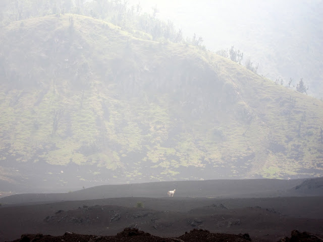
White horse on a black lava field
Normally I am not one to like larger cities, but Xela has so far been so much nicer and more genuine than Antigua.  Hard to explain, but people here are here to live their lives, and not just cater to tourists.  It is definitely refreshing.  After a 3:40am wakeup to get here, we only managed to wander around before having an early dinner, and its not even 8, but I'm ready for bed.

I guess that's about it for now.  Hopefully I'll get to write some posts as I go so check back every once in a while.  Oh, and now that I no longer have a camera, all the pictures that we take will be on Nico's picasa site: picasaweb.google.com/nicotedesco

Thursday, April 14, 2011

Eastbound

For the first time in almost a year and a half, and overcircumventing the globe, I have finally done some traveling going east.  I see that I left off my last post just before doing the inspection of the Cooper River Bridge with Vertical Access.  It was fun to be on rope again in a really cool setting.  Check it out:
Lowering myself down to the cable I was about to inspect
Also for those interested, there is a 2 minute clip of one of my inspection drops on youtube here.  This gives a little bit of an idea of what it is like rolling down the cables.

Redwoods (small ones)
From here I met up with Nico in San Francisco.  Unfortunately the weather was crap, so we went for a hike in the rain in Muir Woods just north of the golden gate bridge.  Even in the shitty weather, there were hordes of people there, but at least I have finally gotten to see some of san fran, the bridge and redwoods.  I now feel like a true American.

It was still too early in the year (too much snow) to get to either Yosemite or Sequoia national parks, so we went straight to Death Valley.  Supposedly the hottest driest place in the country, and we had some of the coldest wettest weather so far on this road trip.
At least the following morning we got to see the snow capped mountains that we drove through the night before; while stopping to check in with 4 disabled vehicles due to the falling rocks!  The next day though, we did the daylong grand tour of death valley.  It is an amazingly diverse place with so much to see.  We hiked up mosaic canyon, played on sand dunes, watched unique pupfish in salt creek, drove around to see multicolored rocks at the "artists palette", and checked out badwater basin - the lowest place in the USA at 282 feet below sea level.  Badwater basin was my favorite place, as it is completely filled with salt, and is right next to 11,000 foot mountains.  That is almost as much as an elevation difference as from Everest base camp to the peak.
Woohoo!

climbing some red rocks
From Death Valley we moved on to Red Rock Canyon, just outside of Vegas.  It may only be 10 miles from the casinos on the strip, but it is a world away.  It had rained the night we got there, and supposedly you are not supposed to climb on the sandstone after rain since it is soft.  We went for a hike instead, although the wetness did not stop the tons of other rock climbers there.  Red Rocks is known for the rock climbing on the vividly colored rocks there.  On our hiking day we went up turtle head peak, which was in a great location to see the whole valley one way, and vegas the other. The following day we got to do some sweet climbing.
multicolored rocks seen from atop turtle head peak, with Vegas in the background
After Red Rocks, we headed to the Grand Canyon.  Amazingly, with our lack of prior planning, we managed to score a campsite in the canyon at Indian Garden.  Most of the campsites are booked 4 months in advance, so we were happy to get something.  This place seems to hold with the pattern of most of our national parks, which is that you can just drive up to anything cool and take a picture.  It was definitely cool to hike all the way down to the Colorado River and back, but really, the best views are from the rim, 100 yards from where you can park your car.  It also wasn't until our last of 3 days there that we saw the sun, which definitely makes it all look more impressive.  Although even without the sun, it still looks cool.  It's amazing to think that all that stuff (that isn't there between the north and south rims) has been washed away by the colorado river.  It's about 16 miles across in places, and gets down to 5000 feet deep.  It is also neat to be kinda looking back in time, as you can see the different rock layers, each one is associated with a prehistoric period of time.
From the Grand Canyon, we finally headed to southern Utah, which is something I'd been looking forward to the whole trip.  It's amazing that even though it is still desert, Utah was so much different than the other stuff we'd been experiencing.  It has got such interesting rock formations and canyons that for over a week that we were there, we were constantly seeing new and interesting things.
Bryce Canyon Panorama
Angel's Landing
Zion is where we went first in the southwest corner of Utah.  I actually wish that we spent more than just a day there, but at this point we both knew that we had to be back in Ithaca by April 18th, and so we were bums on a schedule.  At Zion though we went to Angel's Landing, which apparently is a very well known hike.  And for good reason.  It is this giant piece of rock left in the middle of where 2 rivers meet.  The last half mile of the walk is where it gets really interesting because it is thin, slanted, and quite exposed.  There are just some chains attached to hold onto, with 1200 ft sheer drops on either side.
View from the top of Angel's Landing
From Zion we next went to Bryce Canyon.  This place is home of the Hoodoos, which are freestanding pillars of rock that have been eroded by water and wind from the cliffs that they once were.  Each year Bryce sees about 200 freeze thaw cycles, so in the soft sandstone that leads to lots of erosion.  Here is another place that most of the coolest views are right from the rim where you can park your car, although here we did a day walk in and around some of the hoodoos which was actually quite cool to see them up close.
hiking through a tunnel at Bryce
"The Grand Staircase"
 After Bryce, we went to a small corner of the Escalante-Grand Staircase National Monument where we found "Peek-a-boo" and "Spooky" canyons.  These are some true slot canyons, like the one from "that movie with the guy who got his arm stuck" as many people pointed out to us.  Although that canyon was in the San Rafael uplift (which we went to later).  Anyway, this was probably the best day hike of this entire road trip.  Peek-a-boo required us to climb up into it, and then through all sorts of arches and neat formations.
Peek-a-Boo
Then we went into Spooky canyon which was even tighter - 10 inches wide for a while.  I actually had to take off my backpack and drag it behind me.  There are many more cool pictures of these, and actually all the other stuff too at my picasa site.
Spooky Canyon
Moving on, we had a shorter day hike in the needles section of Canyonlands national park.  This stuff is just general Southern Utah landscape.  Would have been great to get in closer and get to spend a couple nights in the backcountry, but this time our lack of planning meant that everything was booked out.
neat formations in Canyonlands
On the fiery furnace walk
Next stop was Moab, which seems to be the Ithaca of Utah, and the home of Arches National Park.  Here, our lack of planning once again worked out to our advantage.  There is this one section called the "fiery furnace" which is an area of tight fin canyons which are very difficult to navigate, and so you need to get on a ranger guided walk (booked generally 4 months in advance).  It was a nasty morning all windy and pooring rain, and luckily we met up with 2 nice canadian couples whose wives were not interested in the walk.  So we got to stand in for them.  Then luckily that afternoon, the skies cleared and so we got to go on a walk around the Devil's garden - an area with lots of neat arches.  The following day was mostly a rest day to figure out how we're gonna spend our last couple weeks of freedom, and then doing the short walk to the "delicate arch".  This is classic Utah; its even on their license plates.
Delicate arch
looking back down the side canyon
After our days in the Moab area, we drove out to the San Rafael Uplift and to Little Horse Canyon.  We loved the slot canyons so much we decided to seek out another.  This one was certainly really cool with some really narrow parts, although it wasn't quite as interesting as the peek-a-boo and spooky canyons.  I did find a side canyon at some point and enjoyed wandering a bit up there to check it out.  That side canyon actually required a bit more skill to get through which to me made it way more interesting.
In little wild horse canyon
From here, we began our long drive back to the eastern time zone.  3 long day of driving later, we made it to the Red River Gorge in Kentucky and some of the best rock climbing in the country.  It actually felt quite good to see some green trees, soil, humidity, and of course rain and thunderstorms and hail as well.  Our tent got flooded out the first night there, but the climbing was so amazing it more than made up for it.  I have finally gotten comfortable enough with leading that we could climb some more difficult and interesting stuff.  It was unquestionably my best day of outdoor climbing ever.

Right now I am back in North Carolina for just a couple days... hence the time to get out these couple blog posts.  Next week, after 16 months of traveling and being a bum, I finally start working again.  Not as an engineer, but as a farmer.

Sunday, March 13, 2011

Another update

It looks like last time I wrote anything here was after spending a day at Carlsbad Cavers in New Mexico.  Right now I am in a hotel in Charlston, SC.  Here's how I arrived there....

The day after Carlsbad Caverns, we planned to hike up Guadalupe Mtn, the highest in Texas.  As we were about to get on the trail a ranger stopped us saying that the trail was closed due to a forest fire.  We hung around for a few hours, and luckily enough they determined that the trail up the mountain was the only safe one in the park that day.  We went for it, and was rewarded with wind and great views.
Wind


Great Views

Then we headed on to Las Cruces, with first stopping off at the White Sands National Monument.  Its a day trip sort of thing, but really cool!  The sand is white as snow, and was a ton of fun to run up and down the dunes.
Jumping off sand dunes


From there we spent 2 nights with Raimey and Ben, a couple fellow couchsurfers with 3 awesome dogs who kept me entertained constantly.  It was great to spend some time with folks from the area, and interesting ones at that.  They are also rock climbers and told us about a few places nearby that we should check out.  One of them was Franklin Mtns. state park back over in Texas.  There was some nice sport leading there, and it just felt great to get on rope outside and climb some rock.

Then we head into the Gila Wilderness in Western New Mexico.  There are these cliff dwellings there from people who lived in them about 700 years ago.  They have a great story, told by Chuck the volunteer, but most of it is a mystery as to why they built so much and then only stayed 25 years...
Being that it is a national forest / wilderness, we got to camp anywhere and even have fires!  It was also the coldest nights we've had so far (down to 18 deg) so it was really great to hang out by the fire until bedtime.  We did an overnight hike down to the Gila river which is in a canyon with at least 300ft cliffs.  There was also hot springs there that required 15 river crossings to get to each way.
Yay for ice cold water!
Following that mini adventure, we ventured into Arizona - home of the saguaro cactus.  (pronounced sa-wa-ro)  These are the iconic cacti from cartoons, but they actually exist!  and so do roadrunners!  They are also quite interesting, growing up to 50ft tall and hundreds of years old.  They even have woody stems within to keep it upright and can weigh over 15000 lbs.
This one isn't even the largest in the area.
We finally left the Tuscon area after a couple days.  Saguaro national Park is right outside it, and its ugly urban sprawl.  Defo didnt like it there as much as I would have thought.  Only an hour away though is Cochise Stronghold, a climbers dream.  It is a chain of mountains with climbable areas all over.  We went to only one small area that housed 3 crags, and was only a teenie tiny taste of what is there.  The climbing is great too on some nice granite, and this area was well bolted for fun sport leading.
Sweet Rock - our afternoon crag
From Cochise, we head straight to Joshua Tree.  You hear about tons of climbing there, and there is, but  it is all trad leading which we do not have the gear for.  We did manage to find one area with a couple bolts on top that we could toprope off off for half a day.  Then of course there are all the hiking trails too.  And Joshua trees, another crazy plant that looks like it came from a Dr. Suess book. 
Sunset from Key's view

And finally we moved on to something out of the desert!  It is a fascinating landscape and each one is a bit different, but it is really nice to get at something that is not all brown and deserty.  Also, interesting thing we've noticed about the national parks.  They are certainly in our American style of being able to drive up to something, get out of the car for a couple minutes to look at something cool, and then drive on to some other cool thing.  Sure, you can just go wander off up that mountain that is 7 miles from any road or trail, but there seems to be a lack of something inbetween.  Well, there is some, but just not as much as we thought.  Hence, we've kinda been jumping around from park to park spending only a couple days in each cause that is all it takes.  Being that it is desert, we are still limited in how far we can go without a ranger station with a water source.

As we drove towards LA, it was great to get up in the San Bernadino national forest and Big Bear lake, where it is high enough that there was snow on the ground and pine trees and water and colors other than tan!  We did a hike there up to the Pacific Crest Trail and up a mountain close by.  It actually closely reminded me of the adirondacks.  We also happened to be in town to volunteer to help them do a bald eagle count.  So we sat by the lake in our spot and actually spotted one of the 3 Eagles living around this lake for the winter!

So that brings me to LA.  Now Charlston?  Yup, I'm doing a little bit of work with Vertical Access.  Inspecting the Cooper River Bridge.  Its a really sweet one and I get to hang 500ft above the freeway tomorrow!
Nico silhouette - I just like this picture